Guide to hiking the B29 Crash Site Circular on Bleaklow from Glossop
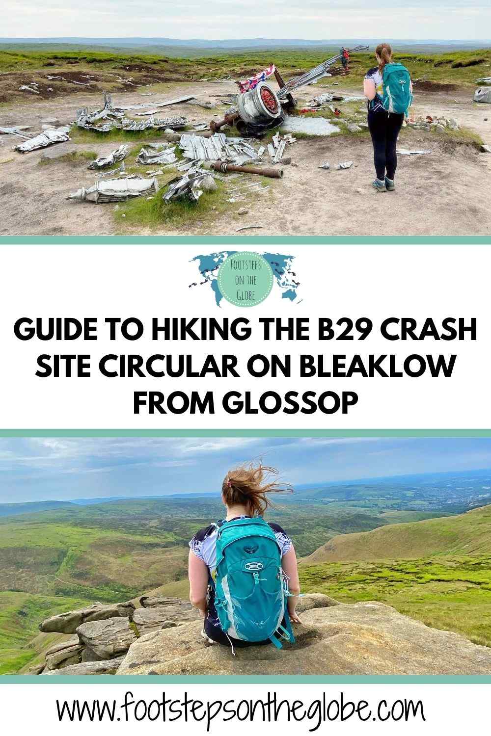
Guide to hiking the B29 crash site circular on Bleaklow from Glossop
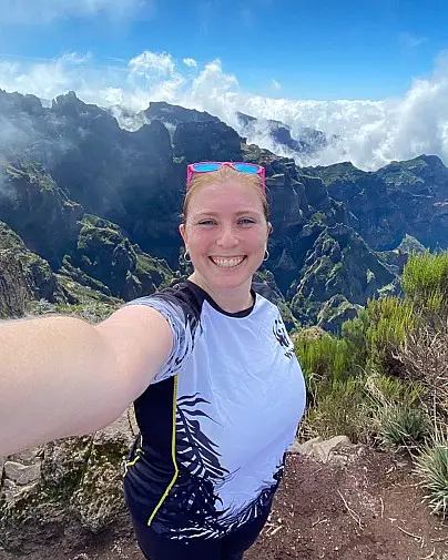
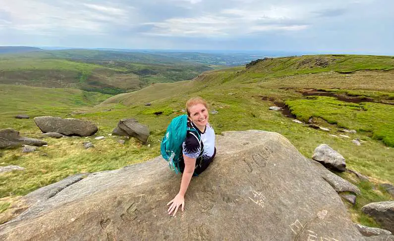
The Bleaklow moorlands near Glossop is one of the most breathtaking areas to go hiking in the Peak District. With interesting and challenging hiking trails, lush green peaks and spectacular valley views, it’s a beautiful place! This area became a popular location for hikers and aviation enthusiasts after the wreckage of the B29 aircraft “Superfortress Overexposed” was discovered here in 1948. The crash site is now a memorial and part of the Glossop to B29 Crash Site Circular hiking trail across Bleaklow and Higher Shelf Stones. Here’s the complete hiking guide!
OTHER hiking POSTS YOU MIGHT LIKE…
- Mam Tor Circular Walks Guide: Routes, difficulty, parking & more!
- Guide to walking Mam Tor: Routes, difficulty, parking & more!
- 15 Tips for climbing Snowdon (to ensure you reach the top!)
- PYG TRACK SNOWDON: Complete guide + top tips for hikers!
- Top 15 tips for climbing snowdon at sunrise
What is the B29 crash site in Glossop?
The B29 crash site is where a United States Air Force B29 bomber plane also known as the “B-29 Superfortress Overexposed” crashed on Bleaklow Moor in the Peak District on 3rd November 1948.
How did the B29 crash in Glossop?
The aircraft was en route from Scampton in Lincolnshire to Burtonwood near Warrington for a training flight when the pilot struggled to navigate due to poor weather conditions.
The plane sadly ended up crashing into the moorland, killing all 13 crew members on board.
Where did the B29 plane crash?
The wreckage of the B29 was discovered in 1949, but due to its remote and treacherous location, it wasn’t until 1988 that a full-scale recovery operation took place.
The crash site has since become a popular location for hikers and aviation enthusiasts and some wreckage and memorials can still be seen at the site today.
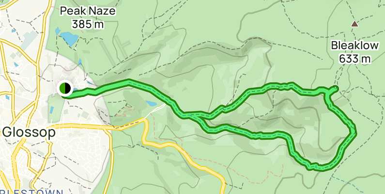
How do you get to the B29 crash site?
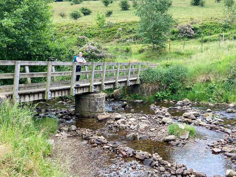
Starting in the lovely medieval market town of Glossop, the trail is about a 15-20 minute walk from the train station.
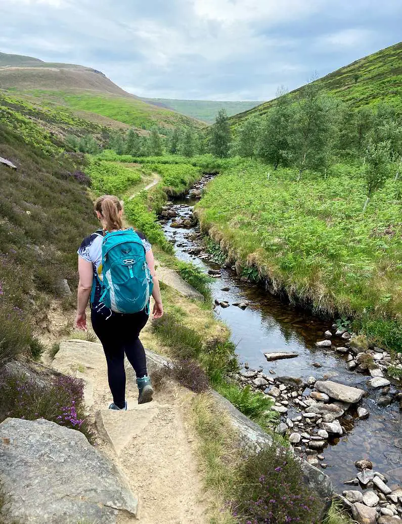
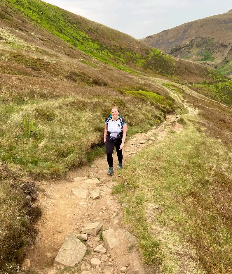
The climb is steep but gradual and plateaus as the route takes you along the moorland across to the B29 crash site. It’s strenuous in places and will require most hikers to take a few short comfort breaks to grab water and a snack.
If weather conditions have been wet you’ll need to be careful climbing over slippery, loose rocks along the rougher patches of the path. The terrain can also be very boggy on the way down the circular.
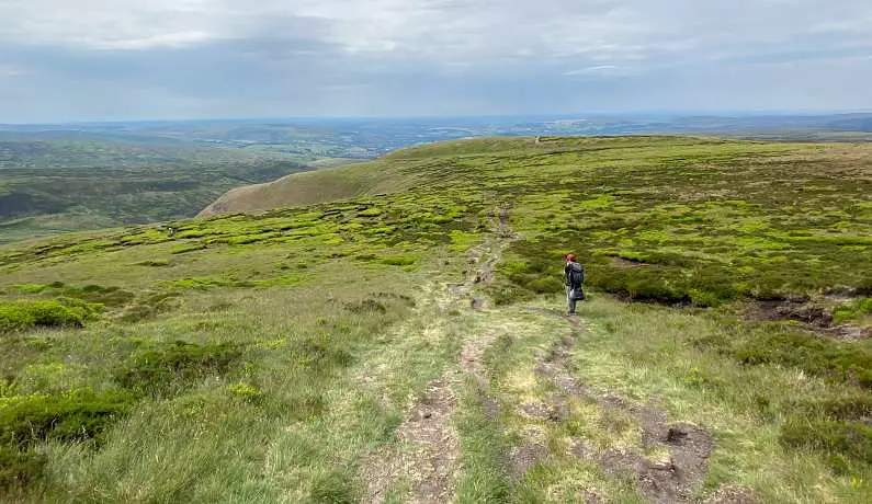
Once you reach the top, the path is straight forward and clearly marked along the moorlands to the crash site.
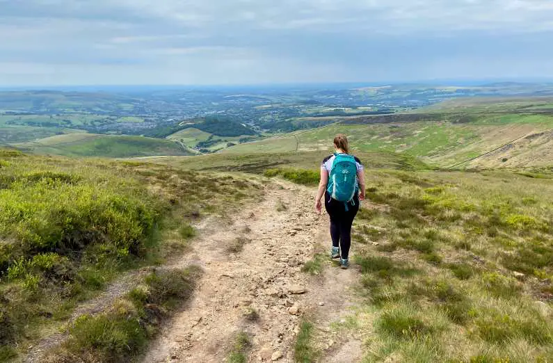
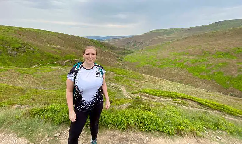
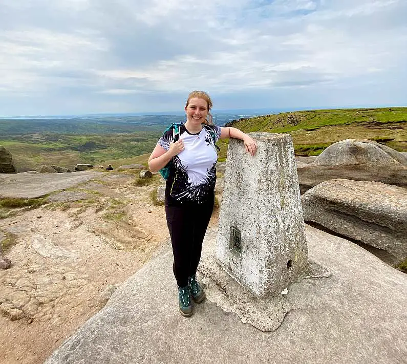
From the crash site, carry on walking along the circular to Higher Shelf Stones where you’ll find some spectacular valley views from the keystone and on the way back down into Glossop.
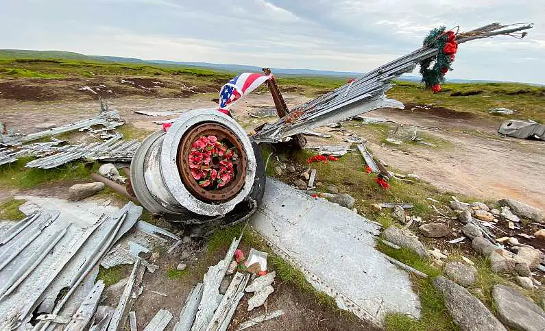
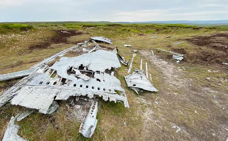
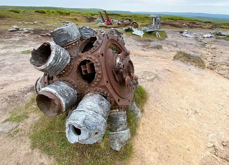
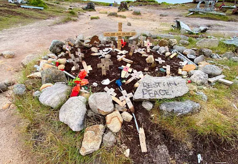
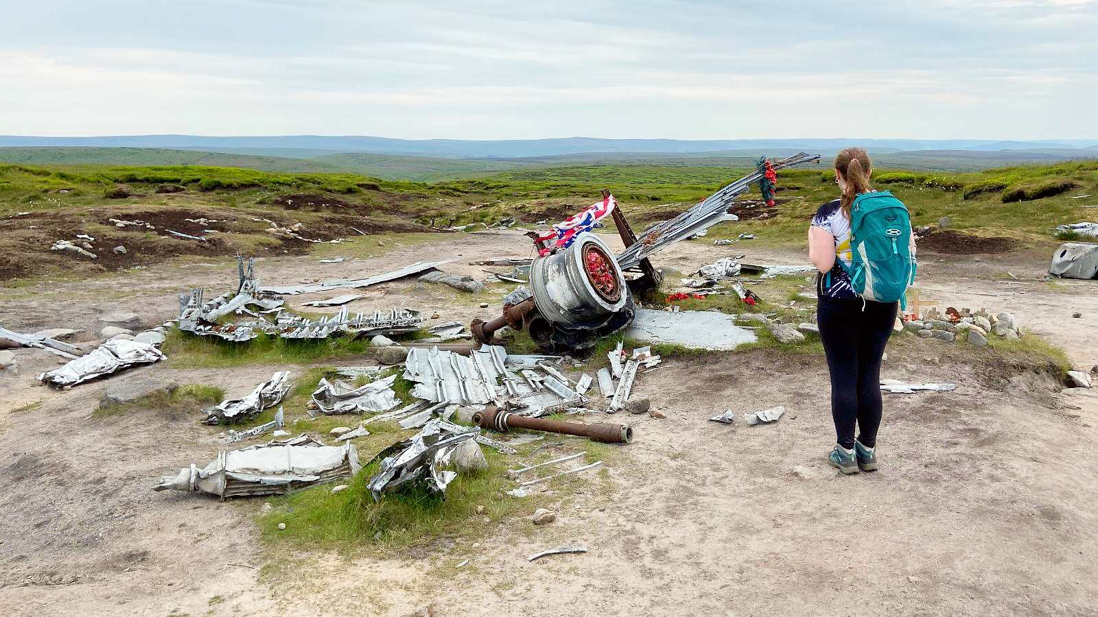
The crash site itself is captivating. There are large parts of the fuselage, wheels and parts of the engine scattered over 400 yards of ground. It’s a harrowing site.
Do keep in mind that the area of the crash is now a memorial site so please be respectful. There is an eerie silence across the Bleaklow moorland and you still feel the sadness in the air over 75 years after the crash.
How do I get to the start of the B29 crash site Circular?
There are two equally easy ways to get to the B29 crash site trail either by train or car.
by train:
The nearest train station to the start of the B29 Crash Site Circular route is Glossop. Trains run to and from Manchester every 30 minutes and only take 30 minutes.
From the train station, it’s only around a 15 to 20 minute walk to the start of the circular route.
by car
The B29 Crash Site Circular is only a 30 minute drive from Manchester and less than an hour’s drive from its other closest cities, Warrington and Sheffield to the start of the route.
There is paid parking in nearby Glossop, less than a quarter mile to the start of the route. You can search for car parks using the Peak District website.
How long is B29 crash site walk?
The hiking trail to the B29 crash site is 8.2 miles and takes an average four and a half hours to complete, which includes a few short breaks.
Is the B29 crash site difficult to hike to?
As a relatively seasoned hiker, I would say that this hike is moderately difficult.
The uneven terrain can be challenging in places and it’s really steep on the way up. But once you get the top, it’s really straight forward. You’re literally walking across moorland at a leisurely pace at the last stretch before the crash site.
On the way down it’s a more steady decline.
Can you drive to B29 crash site?
No, you can’t drive directly to the B29 crash site as it sits on top of the protected Bleaklow moorland so it can only be reached by foot.
However, there is a shortcut that starts at the top of the moorlands. There’s a road along the top of Bleaklow where you can park up and cut onto the path at the top of the moor.
This shorter route will take you about half an hour if you follow the path going round. However, there’s an even shorter path thats takes you through grassland which takes about 15 minutes.
Local rangers encourage hikers to only use this shorter path through the grassland sparingly. This prevents the over-treading of protected vegetation and potential disruption of wildlife.
What should I wear to do the b29 crash site circular?
The British weather is unpredictable at the best of times. But you can times that unpredictability factor by 10 when you’re climbing any mountain or high hill in the Peak District – especially Glossop!
Over the years I’ve been hiking I’ve found that no matter how high the mountain or hill, they always seem to make their own weather!
And no matter what the weather looks like when you start, it’s likely to change very quickly or be different once you reach the top!
When I go hiking during the summer or early autumn, I wear water-resistant sports leggings and a nylon t-shirt that won’t rub on me as I begin to sweat.
I also take a simple lightweight, waterproof jacket that can easily be rolled up into my backpack.
If it’s raining on the day of your climb, I would recommend wearing a pair of waterproof over-trousers. You can always take them off when the rain stops.
You’ll also need to take a warm layer (a jumper or mid-layer fleece jacket) in case you get cold at the top or the weather turns.
However, no matter the weather, it gets colder the higher the altitude, so make sure to pack an additional layer just in case as the moors are very exposed.
ALL THE CLOTHES YOU’LL NEED for hiking the b29 Crash Site Circular:
- Hiking boots (I have these ones in green and they’ve lasted me for years and are still good as new!)
- Hiking socks (these will protect your feet from friction and decrease your chances of getting blisters. As well as keep your feet dry and cool with more breathable and comfortable material)
- Lightweight, waterproof jacket (this is essential even in the summer because the weather can turn at any point in the Peak District)
- Water-resistant sports leggings and waterproof over-trousers (this is my personal preference as I just like having the movement and breathability that sports leggings provide with the insurance of having waterproof over-trousers to put over the top if the weather turns or I start to get cold) OR fleece-lined waterproof trousers (for colder weather)
- Nylon/ polyester t-shirt (avoid cotton as it absorbs moisture so it’ll trap against your skin, making you feel damp and hot as you sweat. This can also cause rubbing which gets super uncomfortable the longer you hike)
- Mid-layer fleece jacket (or jumper)
- Baseball cap or bobble hat (depending on what time of year you go)
What do I need to pack for my hike?
The B29 Crash Site Circular is quite a long hike, especially if you want to spend some time enjoying the views at the top – so you’ll need to pack a few essentials!
I advise you to take a light weight, waterproof backpack (emphasis on the waterproof!) due to the unpredictability of the weather and pack the following:
- Lightweight, waterproof jacket (even on hot days the weather may turn or the wind will pick up at the top – these jackets roll up really small in your bag and are super lightweight)
- Mid-layer fleece jacket (just in case it gets chilly – especially when you’re descending and starting to cool down)
- Baseball cap or bobble hat (depending on what time of year you go)
- Minimum of a litre of water (if it’s a hot day you’ll need to take more)
- Refillable water bottle (these sports bottles are lightweight, leak-proof and BPA-free, which are perfect for hiking! I also use one at home to make sure I’m drinking enough water throughout the day. The bottles have handy time markings on them to show you how much water you should be drinking by which time. Alternatively, I would recommend a hydration bladder which are also great for hiking. They’re BPA-free, leak-proof and compact with an on/ off valve that makes drinking on the go really easy. There are a couple of streams you can refill your bottle up at before the final ascent)
- Compeed blister plasters
- Light weight roll on suncream (this nifty suncream takes up minimal space in your backpack and is easy to apply on the go as a roll-on)
- Mini portable charger
- High-carb snacks e.g. Graze and Deliciously Ella (which are my faves!) – you won’t need to pack a lunch if you’d prefer to eat at one of the local eateries in Glossop afterwards but if you fancy sitting at the top to savour the view, definitely take a pack lunch and enjoy a picnic at the top!
Is the B29 crash site circular hike suitable for children?
No. I wouldn’t take children on the full circular hike. Not only because it’s a long hike but it’s a difficult one. There’s lots of uneven terrain and it’s very boggy in places. It’s also really steep on the way to the top – a bit much for little ones!
I’d only take children if the weather was good and you hike from the road at the top of the moorland. There and back to the crash site is only about an hour’s hike and the path is pretty even and easy to follow.
If you have a toddler I recommend a toddler hiking backpack just in case they get fussy or tired after walking on the shorter path.
The OE Hiking Carrier For Child and Toddler is comfortable for parents and toddlers with great hip support, sunshade and detachable backpack. It can also be used as a regular nappy bag when it’s folded down.

Is the B29 crash site circular hike dog friendly?
I’d maybe not take a small or older dog on the B29 Crash Site Circular hike. I have two very energetic cockapoos so I know I can take them out hiking for hours and they’re fine. But of course you know your dog best!
If you do want to take your dogs I’d recommend getting a longer sports lead because the terrain is very uneven so you don’t want them pulling. If you’re looking for one that is affordable but durable, I’d get the Barkswell Hands Free Dog Lead.
These leads are specifically designed for more high intensity sports with your dog. They have a bungee design that is shock absorbing so you won’t feel your dog pull as you climb.
The leads also attach to a belt around your waist so you’re able to hike hands-free. This comes in very handy when you’re scaling mounds of uneven rocks!
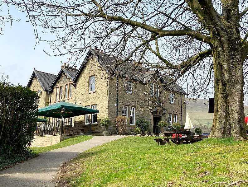
Is there anywhere to eat near the hiking trail?
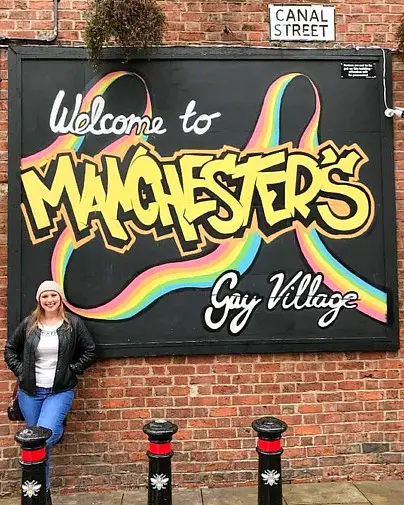
Glossop has got some great country pubs and small restaurants to choose from with vegan and vegetarian options as well.
- Pico Lounge – lovely bar and eatery with a separate vegan menu. The restaurant is part of the Loungers group in Manchester and has a wide selection of great food no matter what your dietary requirements. I was in there every week when I lived in Chorlton!
- The Victoria Lounge – local pub serving vegan options. They also do wood fired pizzas with vegan toppings, including: pepperoni, bbq chicken and Thai chickpea.
- Ayubowan – a lovely little Sri Lankan restaurant which holds a vegan evening the last Sunday of each month. It also has a selection of vegan curries and other vegan dishes labelled throughout the whole menu.
- The Oakwood – pub in the centre of Glossop offering vegan options, including: seitan burger and chips, cauliflower wings, a vegan sharing platter and a vegan roast dinner on Sundays.
- Norfolk Arms – a lively pub in the centre of Glossop offering a few vegan options, including: five bean vegan chilli and rice, vegan wraps and sweet potato curry. Although the pub is nice, it gets very rowdy with weekend drinkers watching sports so if that’s not your vibe after a tiring day of hiking, I’d recommend the other eateries above! Also there was only one vegan option available on the day I visited. It was nice food but as a chained pub I expected more options to be available as stated on their menu.

Is the B29 Crash site circular hike worth it?
Yes! Bleaklow has some of the Peak District’s most breathtaking hikes. With interesting and challenging trails, lush green peaks and spectacular valley views, it’s a beautiful place.
The crash site itself is truly harrowing. It stands as a historic memorial for those lost in the crash in 1948.
Hiking kit LIST:
- Hiking boots
- Hiking socks
- Lightweight, waterproof jacket
- Osprey Waterproof Hikelite Backpack
- Water-resistant sports leggings and waterproof over trousers OR fleece-lined waterproof trousers (for colder weather)
- Nylon/ polyester t-shirt
- Mid-layer fleece jacket
- Baseball cap or bobble hat
- Compeed blister plasters
- Roll on suncream
- Mini portable charger
- A litre of water for the start of your hike
- Refillable water bottle or hydration bladder
- High-carb packed lunch and protein bar snacks (Graze and Deliciously Ella are my faves!) – optional if you’d prefer not to eat in the pub or cafe afterwards
OTHER hiking POSTS YOU MIGHT LIKE…
- Mam Tor Circular Walks Guide: Routes, difficulty, parking & more!
- Guide to walking Mam Tor: Routes, difficulty, parking & more!
- 15 Tips for climbing Snowdon (to ensure you reach the top!)
- PYG TRACK SNOWDON: Complete guide + top tips for hikers!
- Top 15 tips for climbing snowdon at sunrise
Have a wonderful day on hiking in Glossop my loves! Don’t forget to come back and share your experience in the comments below! 😄

Quick FYI guys – this post contains affiliate links to products. I will receive a small commission for purchases made through these links at no extra cost to you. Thanks so much for your support!